Sunday, January 29, 2006

Update...

Well...I am back at school. Have been for two weeks now. It's been a weird start to the semester. My roommate up and moved out (quit school for the semester) just a day after moving back in, so I have this room to myself, although I still share this apartment with one other person. I experienced extreme deja vu during the introduction of one of my new classes because the professor wants us to do two group projects during the semester that involve an oral presentation and a written report in almost exactly the same format as I did in a class I took last semester. You know those professors have been comparing notes.

I've made some long-overdue updates to the Stoughton Piston Head Society website, including starting work on my account of the Stoughton tornado of August 18, 2005. I've also made some additions to the SPC high risk archive and put together a page of random links to bands/musicians I like.

Friday, January 27, 2006

Sure feels like March out there...

Friday, January 13, 2006

Weather Event #3-January 12-13 Severe Storms & Tornadoes

Reports on today's severe thunderstorm outbreak with tornadoes across Alabama, Georgia, North/South Carolina, Virginia, and Florida:

NWS Birmingham-Barbour County Alabama tornado
WKRG Ch. 5
WSFA Ch. 12
WJHG Ch. 7
USA Today

SPC Storm Reports

Tragically we have our first tornado death of 2006...only took until January 13th to happen. In 2005 there were tornado fatalities on consecutive days-January 12th and 13th. The first deadly tornado in 2004 wasn't until April 20th.

The deadliest tornado in 2005 hit Evansville, Indiana on November 6th, killing 22 people because it struck the worst possible place at the worst possible time-a trailer park, in the middle of the night, when people are asleep and don't get the warnings.

By comparison, the tornado that hit Stoughton on August 18, 2005 was of similar size (1/4-1/2 mile wide) and intensity (high F3) hit during daylight, was slow-moving, hit frame houses, and caused one death.

More info

Friday's storms evolved from a squall line that formed in eastern Oklahoma, eastern Texas and western Arkansas on the evening of Thursday, January 12. A supercell embedded in that line produced an F2 tornado in Pope and Yell Counties, Arkansas.

NWS Little Rock
SPC Storm Reports

Thursday, January 12, 2006

Weather Event #2

Wednesday, January 11, 2006: "Surprise" tornado near Jamestown, Virginia:

This F1 tornado caused 2 minor injuries and destroyed several trailer homes. Wind shear profiles were extremely favorable for tornadoes, but atmospheric instability was virtually nonexistent, so the probabilities of a tornado developing were thought to be too low to mention tornadoes in a forecast (convective outlook, mesoscale discussion, or tornado watch). Anything can happen as long as the probability is non-zero, though.

WAVY-TV-Tornado Injures Two in James City County
SPC Storm Reports

000
WFUS51 KAKQ 112319
TORAKQ
VAC095-199-830-112345-
/O.NEW.KAKQ.TO.W.0003.060111T2319Z-060111T2345Z/

BULLETIN - EAS ACTIVATION REQUESTED
TORNADO WARNING
NATIONAL WEATHER SERVICE WAKEFIELD VA
619 PM EST WED JAN 11 2006

THE NATIONAL WEATHER SERVICE IN WAKEFIELD HAS ISSUED A

* TORNADO WARNING FOR...
CITY OF WILLIAMSBURG IN SOUTHEAST VIRGINIA
JAMES CITY COUNTY IN SOUTHEAST VIRGINIA
YORK COUNTY IN SOUTHEAST VIRGINIA

* UNTIL 645 PM EST*

AT 615 PM EST...NATIONAL WEATHER SERVICE DOPPLER RADAR INDICATED A SEVERE THUNDERSTORM CAPABLE OF PRODUCING A TORNADO NEAR GOVERNORS LAND...OR ABOUT 6 MILES NORTH OF SURRY...MOVING NORTHEAST AT 30 MPH.*

THE TORNADO IS EXPECTED TO BE NEAR...
WILLIAMSBURG AND KINGS POINT BY 625 PM EST...
OAKTREE...EWELL AND LIGHTFOOT BY 630 PM EST...
CAMP PEARY...SKIMINO...BARLOWS CORNER AND CHRISTENSONS CORNER BY 635 PM EST...

DO NOT USE YOUR CAR TO TRY TO OUTRUN A TORNADO. CARS ARE EASILY TOSSED AROUND BY TORNADO WINDS. IF YOU ARE CAUGHT IN THE PATH OF ATORNADO...LEAVE THE CAR AND GO TO A STRONG BUILDING. IF NO SAFESTRUCTURE IS NEARBY...SEEK SHELTER IN A DITCH OR LOW SPOT AND COVERYOUR HEAD.

THE SAFEST PLACE TO BE DURING A TORNADO IS IN A BASEMENT. GET UNDER A
WORKBENCH OR OTHER PIECE OF STURDY FURNITURE. IF NO BASEMENT ISAVAILABLE...SEEK SHELTER ON THE LOWEST FLOOR OF THE BUILDING IN ANINTERIOR HALLWAY OR ROOM SUCH AS A CLOSET. USE BLANKETS OR PILLOWS TOCOVER YOUR BODY AND ALWAYS STAY AWAY FROM WINDOWS.

IF IN MOBILE HOMES OR VEHICLES...EVACUATE THEM AND GET INSIDE ASUBSTANTIAL SHELTER. IF NO SHELTER IS AVAILABLE...LIE FLAT IN THENEAREST DITCH OR OTHER LOW SPOT AND COVER YOUR HEAD WITH YOUR HANDS.

LAT...LON 3724 7688 3718 7675 3732 7664 3741 7673

Tuesday, January 03, 2006

Stirring up a Hornet's Nest is OK When They're All Dead or Hibernating

As promised, here are some photos of the hornet nests I collected last week. The milk jug is for scale.


Some deceased residents I found inside one of the nests:

Monday, January 02, 2006

Weather Event #1

Reports on today's severe thunderstorm outbreak in the Ohio Valley and Southeast:

Georgia:
http://www.11alive.com/news/usnews_article.aspx?storyid=74023
January's Springlike Outbreak of Severe Thunderstorms

Kentucky:
FINAL REPORT: Storms of January 02, 2006
Elizabethtown tornado picture
Lexington Herald-Leader Article

All:
http://www.spc.noaa.gov/climo/reports/060102_rpts.html

Tornado count as of 6:50 PM CST 1/07/2006:

6 tornadoes in Louisville County Warning Area (north-central and central KY)
3 F2
3 F1

6 tornadoes in Peachtree City County Warning Area (northwestern and central GA)
1 F3
1 F2
3 F1
1 F0

1 tornado in Charleston County Warning Area (southern SC and northeast GA)
1 F0

PUBLIC INFORMATION STATEMENT
NATIONAL WEATHER SERVICE CHARLESTON SC
847 PM EST TUE JAN 3 2005

...NATIONAL WEATHER SERVICE CONFIRMS A TORNADO SOUTH OF MILLEN GEORGIA...

A DAMAGE ASSESSMENT TEAM FROM THE NATIONAL WEATHER SERVICE FORECAST OFFICE IN CHARLESTON SOUTH CAROLINA SURVEYED DAMAGE THAT OCCURRED FROM A SEVERE SUPERCELL THUNDERSTORM THAT MOVED THROUGH MUCH OF CENTRAL AND SOUTHERN JENKINS COUNTY GEORGIA BETWEEN 9 PM AND 930 PM MONDAY EVENING. DAMAGE OCCURRED IN SEVERAL COMMUNITIES THROUGHOUT THE COUNTY WITH THE MOST SEVERE DAMAGE BEING OBSERVED ABOUT 10 MILES
SOUTH OF MILLEN

....TRACK REVIEW...
A LINE OF SEVERE THUNDERSTORMS MOVED RAPIDLY EAST OUT OF BURKE AND EMMANUEL COUNTIES MONDAY EVENING. A LARGE AND DANGEROUS LONG TRACK SUPERCELL ON THE TAIL END OF THE LINE MOVED INTO THE SOUTHWESTERN PORTION OF JENKINS COUNTY...ABOUT 8 MILES SOUTH OF HERNDON...SHORTLY BEFORE 9 PM. THE STORM MOVED INTO THE COMMUNITY OF BUTTS AROUND 910 PM WHERE SCATTERED TREES WERE BLOWN DOWN. THE DAMAGE TEAM FOUND NO EVIDENCE OF A TORNADO...BUT HAS DETERMINED THE TREES WHERE BLOWN DOWN BY STRAIGHT LINE WINDS IN EXCESS OF 60 MPH.

THE SUPERCELL CONTINUED TO MOVE RAPIDLY EAST AROUND 50 MPH INTO AN AREA BETWEEN MILLEN AND FOUR POINTS. AROUND 915 PM...HIGH WINDS OVERTURNED AND SEVERELY DAMAGED AN UNSECURED MOBILE HOME OFF U.S. HIGHWAY 25 AND DAMAGED OTHER NEARBY STRUCTURES. A SECOND MOBILE HOME HAD ITS PORCH BLOWN OFF AND ROOF PEELED BACK. TWELVE TREES NEAR BOTH HOMES WERE ALSO BLOWN DOWN. THE DAMAGE TEAM HAS DETERMINED THAT A TORNADO OF F0 INTENSITY MOVED THROUGH THIS AREA WITH ESTIMATED WINDS OF 60-70 MPH. THE TORNADO WAS 25 YARDS WIDE AND WAS ON THE GROUND FOR 75 YARDS BEFORE LIFTING.

THE STORM MOVED INTO THE COMMUNITY OF SCARBORO IN THE SOUTHEAST PORTION OF JENKINS COUNTY BY 925 PM. HERE HIGH WINDS BLEW DOWN TREES OFF OLD SAVANNAH ROAD. THE TEAM HAS DETERMINED THAT THE TREE DAMAGE WAS CAUSED BY STRAIGHT LINE WINDS IN EXCESS OF 60 MPH AND NOT BY A TORNADO. THE SUPERCELL THUNDERSTORM EXITED JENKINS COUNTY SHORTLY BEFORE 930 PM.

...TORNADO STATISTICS...
LOCATION... 10 MILES SOUTH OF MILLEN GA
TIME OF OCCURRENCE... 915 PM
F-SCALE RATING... F0
ESTIMATED WINDS... 60-70 MPH
TORNADO WIDTH... 25 YARDS
TORNADO TRACK LENGTH... 75 YARDS

THE NATIONAL WEATHER SERVICE IN CHARLESTON WISHES TO THANK THE CITIZENS OF JENKINS COUNTY...THE SAVANNAH AND AUGUSTA BROADCAST MEDIA AND LOCAL EMERGENCY MANAGEMENT OFFICIALS FOR THEIR HELPYESTERDAY EVENING AND TODAY.

Two tornadoes also developed during the early morning hours of January 2nd, 2006 over eastern Missouri (LSX CWA):

St. Charles County
St. Louis County

Glad to see only a few minor injuries out of this. There were some very impressive supercells producing strong (F2-F3) and potentially highly destructive tornadoes. With the often poor visibility and density of mobile homes in the Southeast, tornadoes there are often deadlier than in other parts of the country.

Sunday, January 01, 2006

Why this blog exists...

I guess I wanted to start a blog because it just makes it a heck of a lot easier to keep up a running commentary on the Internet. I like to be able to post regular observations about certain things; such as my two favorite hobbies, wasp watching and storm chasing. Last year I tried to maintain a webpage with comments and information about each new storm event, and having to go in and edit HTML for each new event got old real fast.

Of course...it is January so both of those activities are kind of in the off season, but that doesn't mean interesting stuff can't happen.

Last Thursday, I spotted two bald-faced hornet (Dolichovespula maculata) nests within a block of each other, up in trees in people's front yards in Stoughton. Using a long-handled clippers and a box to catch them I cut them down and added them to my collection. One is pretty much fully intact, and has branches woven into it in such a way that they make a nice built-in tripod to stand it up. The other has a big hole in it, so the cells inside are easily visible. I'll add some photos later.

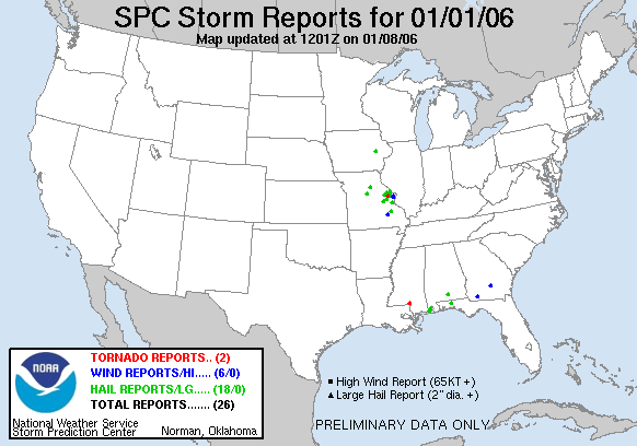
Meanwhile, the 2006 severe weather season isn't wasting any time. After a very convoluted 2005 (the most active months were August and November, instead of April and May) one tornado has already touched down in Mississippi.


A widespread outbreak of severe thunderstorms may be in store for the southeastern United States tomorrow.

A New Blog for a New Year

My family and I finished up our traditional New Year's Eve Scrabble game at about 12:30, and I was still pretty wired from the two RC Colas I drank. I went online to check up on a few things and the thought occurred to me that now (2:25 AM CST on January 01, 2006) was as good a time as any to set up a blog, which was something I had had in mind for awhile.

So here it is...random happenings at random times and places.

Happy 2006!